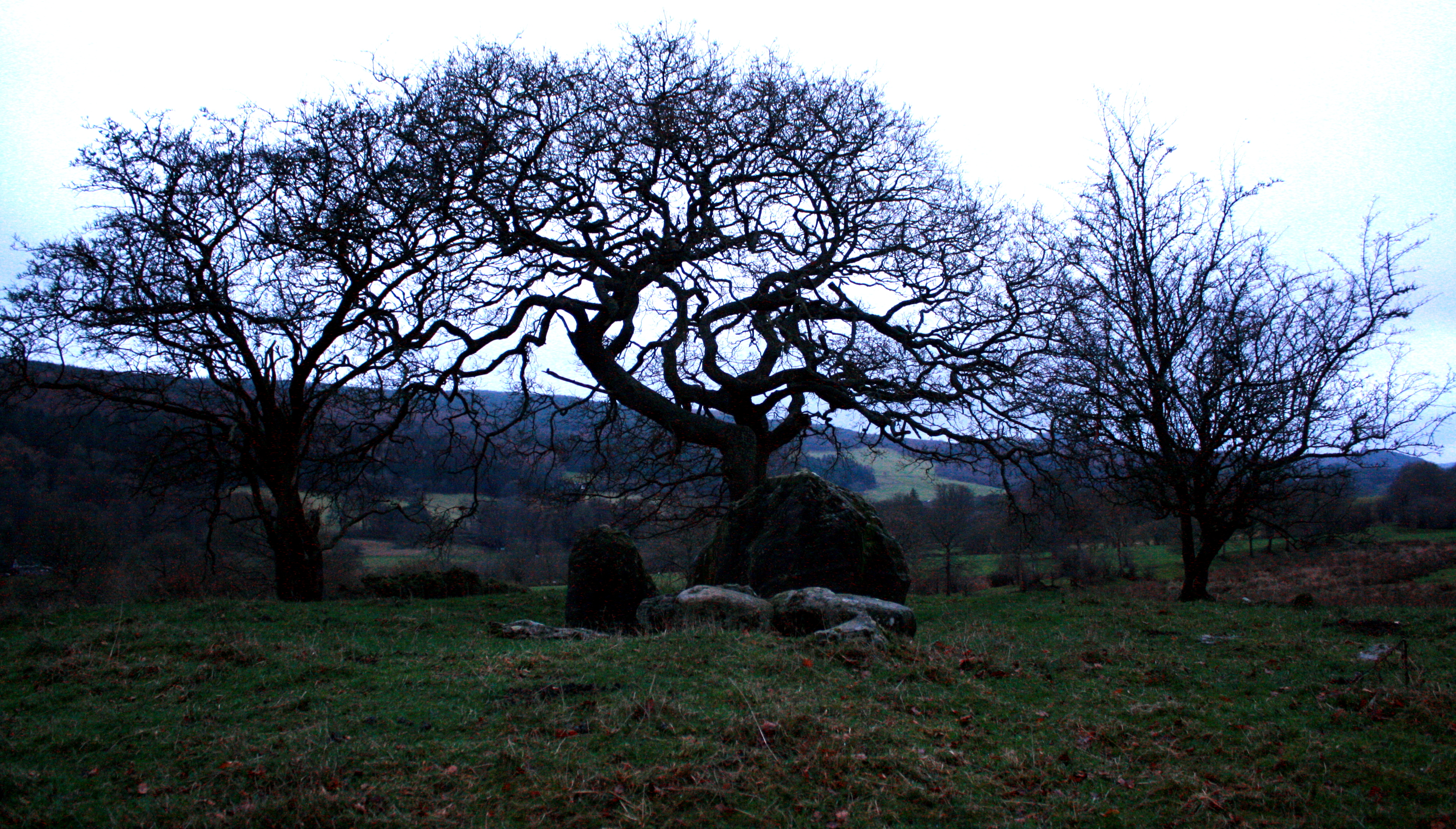
Llangar Old Church dates from at least the thirteenth century when it is mentioned in documents . The use of the site may be much earlier .
The following extract from CPAT provides a background to the history of the church. Clwyd Powys Archaeological Trust Historic Settlement Survey – Denbighshire – 2014
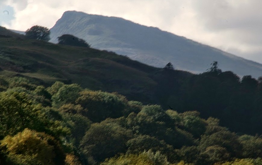
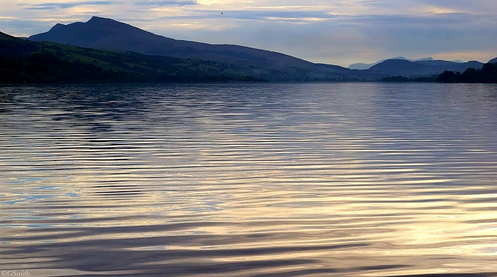
Set in a remote spot where the confluence of the River Dee and its tributary the Alwen creates
unusually extensive low-lying levels, Llangar church is set into a steep west-facing hillside
just above the main river with the Berwyn massif providing a back drop. The B4401, a former
turnpike road linking Bala and Llangollen, runs along the valley edge above the site, while a
now dismantled railway between the same two centres has left its terraced course immediately
below the churchyard. Corwen is less than 2km to the north-east. Llangar was in Merionnydd
until 1974 when it was transferred to Clwyd and in turn to Denbighshire in 1996.
This brief report examines the emergence and development of Llangar up to the year 1750.
For the more recent history of the settlement, it might be necessary to look at other sources of
information and in particular at the origins and nature of the buildings within it.
The continuous line defining the historic core offers a visual interpretation of the area within
which the settlement developed, based on our interpretation of the evidence currently to hand.
It is not an immutable boundary line, and will require modification as new discoveries are
made.

History of development
The earliest reference in the Norwich Taxation of 1254 is to Langar with a similar spelling in
the later taxation of 1291, and Llangar in a document of 1292/3, revealing little change to the
place-name over eight centuries. There were, however, minor variations over the centuries, as
in 1370 when we read of Thlangair in Edeyrnyon. Archdeacon Thomas claimed that there was
another old name for the parish, Llan-garw-gwyn, but Melville Richards’ place-name archive
indicates that this term was current only in the 18th century.
According to Samuel Lewis in the earlier part of the 19th century, the name was derived from
‘an ancient fortification which formerly occupied the summit of a hill called Caer Wern, in the
immediate vicinity of the church, and of which there are still some vestiges…’. This
interpretation has found little favour in more recent times and the late Derek Pratt argued for a
personal name ‘Car’, related to modern Welsh ‘car’ meaning kinsman or friend.
There is no record of a settlement here, excepting the nearby farm of Stamp and the loosely
nucleated settlement of Bryn Saint, 300m higher up the slope. The latter was certainly in
existence in the mid-19th century, but how much earlier is impossible to ascertain. Edward
Lhuyd’s correspondent at the very end of the 17th century made a point of noting the absence
of any house by the church.
The heritage to 1750
The church of All Saints (100815), from 1967 a guardianship site in the care of Cadw, is at
least as old as the 13th century, but it is probable that there has been a church or chapel on the
site since before the Conquest. Much of the structure is post-medieval, and date stones in the
walls indicate rebuilding between 1615 and 1620 and the erection of the porch in 1617. The
west wall was rebuilt sometime after 1656 and again in the early 17th century. Excavations in
the 1970s found nothing pre-dating the 14th century. The church however escaped
Victorianisation, largely because it was superseded, in 1856, by a new church in Cynwyd.
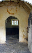
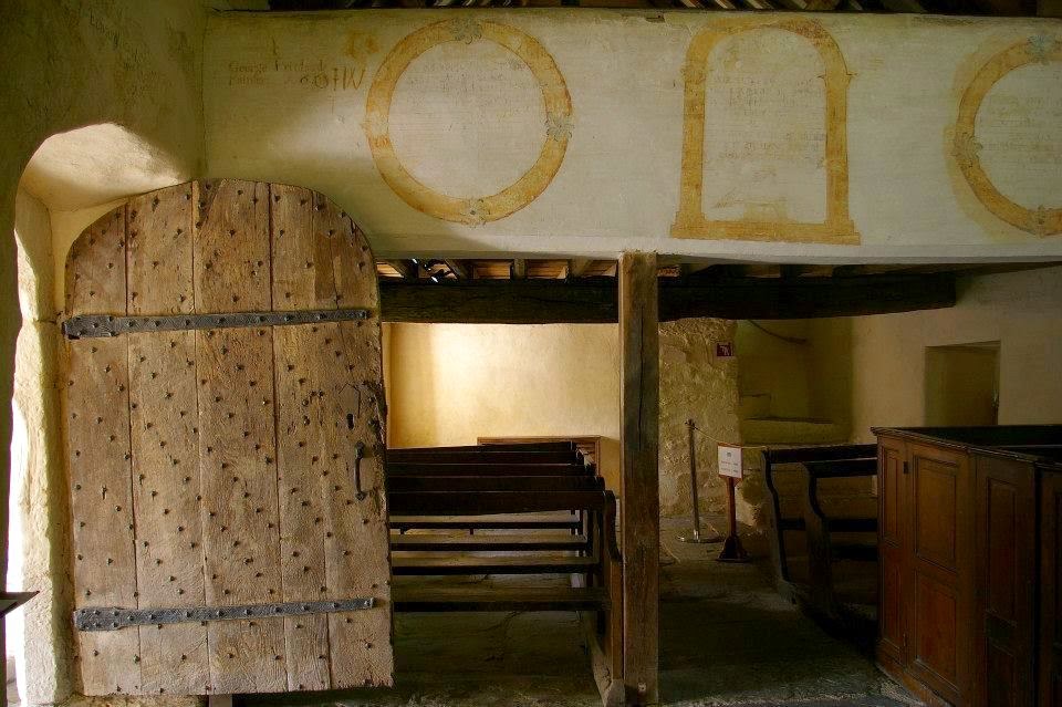
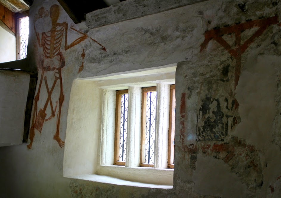
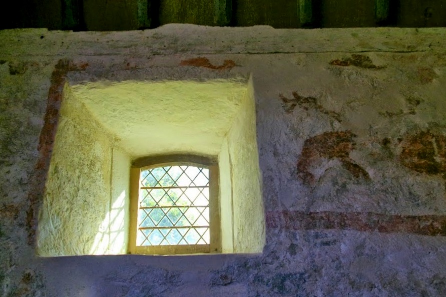
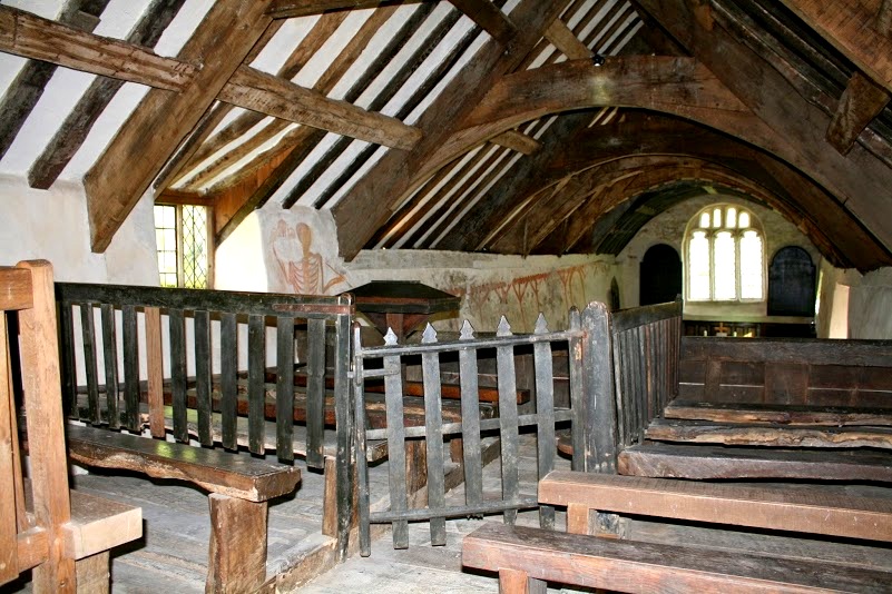
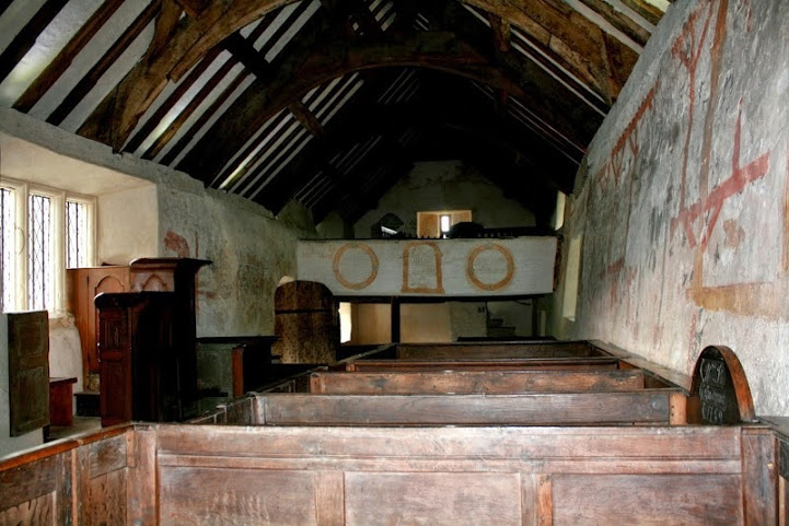
The windows are largely of 17th- and 18th-century date. A simple exterior is matched
internally by stone-flagged floors, box pews, a three-deck pulpit and a west gallery. From the
medieval era there are roof trusses and fragmentary wall paintings (with others of the 18th
century), and a font that is 12th or 13th-century.
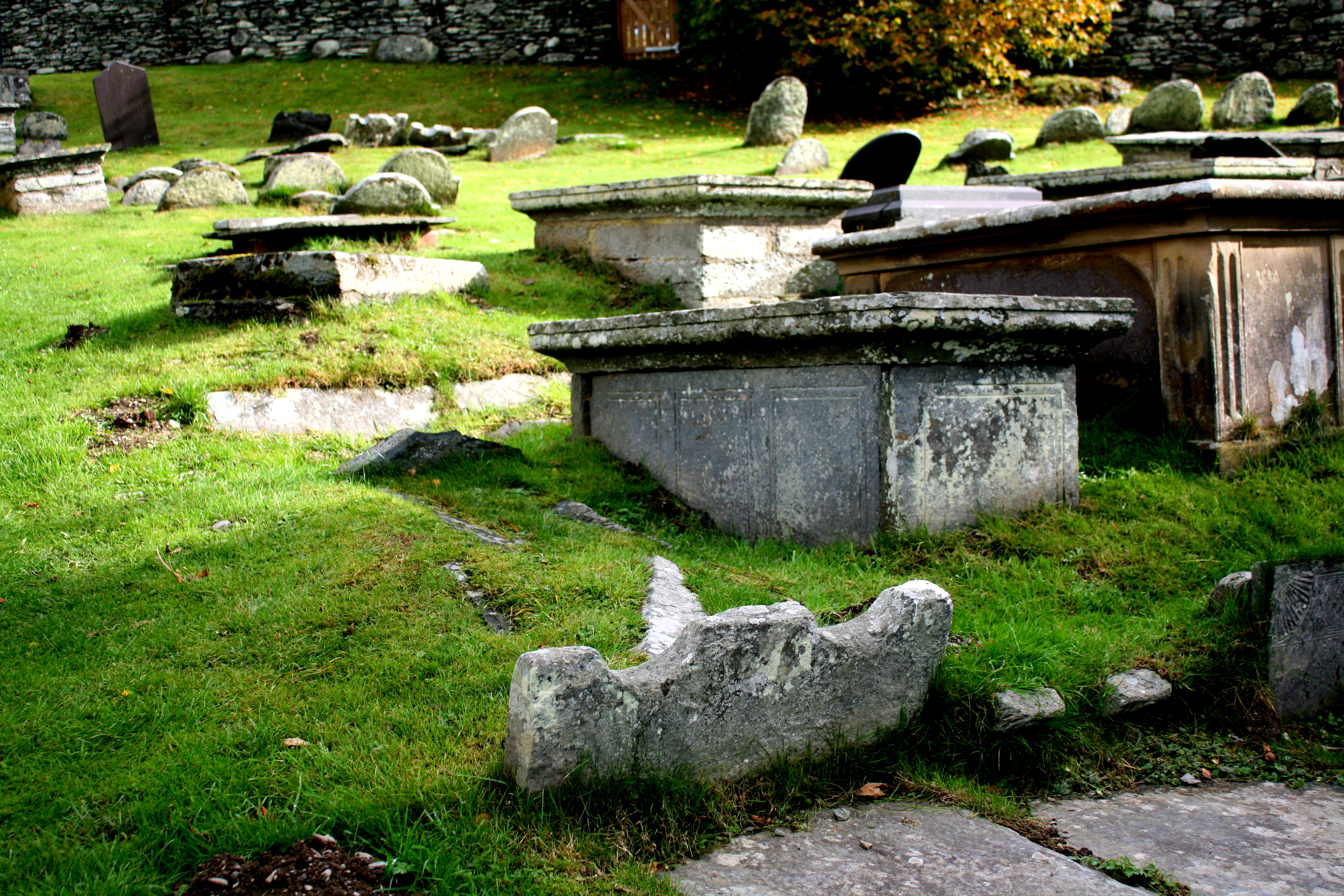
The churchyard (19761) is of irregular shape, as a result of extensions, and set on a relatively
steep slope. An original curvilinear form is suggested on the south side and on both the west
and east there are traces of an earlier boundary within the present enclosure, the former
merging with the platform supporting the church itself. The lychgate on the south side carries
a date of 1731.

Earthworks (100829) have been recorded in the past in the bracken-covered field to the north
of the church and in pasture just to the east of the main road. The former may be no more than
a medieval or later lynchet and perhaps a quarry, while the significance of the others is
uncertain. The track leading to the church from the south is certainly of some antiquity and is edged by flattish ground suitable for occupation.
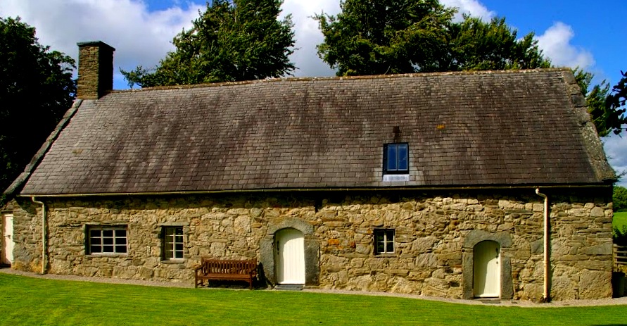
Hafod-yr-afr (104521), some 300m to the east of the church is recorded as a cusped cruckframed
house of post-medieval date. Its inclusion here underlines the dispersed nature of local
settlement and the absence of any nucleated community.
The heritage to 1750
The church of All Saints (100815), from 1967 a guardianship site in the care of Cadw, is at least as old as the 13th century, but it is probable that there has been a church or chapel on the site since before the Conquest. Much of the structure is post-medieval, and date stones in the walls indicate rebuilding between 1615 and 1620 and the erection of the porch in 1617. The west wall was rebuilt sometime after 1656 and again in the early 17th century. Excavations in the 1970s found nothing pre-dating the 14th century. The church however escaped Victorianisation, largely because it was superseded, in 1856, by a new church in Cynwyd.
The windows are largely of 17th- and 18th-century date. A simple exterior is matched
internally by stone-flagged floors, box pews, a three-deck pulpit and a west gallery. From the
medieval era there are roof trusses and fragmentary wall paintings (with others of the 18th
century), and a font that is 12th or 13th-century.

The churchyard (19761) is of irregular shape, as a result of extensions, and set on a relatively
steep slope. An original curvilinear form is suggested on the south side and on both the west
and east there are traces of an earlier boundary within the present enclosure, the former
merging with the platform supporting the church itself. The lychgate on the south side carries
a date of 1731.
Earthworks (100829) have been recorded in the past in the bracken-covered field to the north
of the church and in pasture just to the east of the main road. The former may be no more than
a medieval or later lynchet and perhaps a quarry, while the significance of the others is
uncertain. The track leading to the church from the south is certainly of some antiquity and is
edged by flattish ground suitable for occupation.
Hafod-yr-afr (104521), some 300m to the east of the church is recorded as a cusped cruckframed
house of post-medieval date. Its inclusion here underlines the dispersed nature of local
settlement and the absence of any nucleated community.
However there are other forces at play when it comes to finding the right spot to found a church in medieval Wales ..if you stand in the upper gallery and look around the story of the church is painted on the walls . The church has a few secrets including the Daisy wheels carved into the door and the story of ghostly singing when the church is empty. These will be discussed in part 2

Llangar Gallery

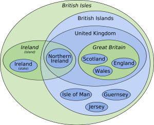 ‘The British Isles’ euler diagram from wikipedia